
Creating an illustrated map is so much easier than it was pre-google maps and street view era. Still its a challenge to create a realistic map that is functional and looks like the real space. As I live down the road from Blair Atholl and know a few folk who live there I wanted to get most of the houses and businesses right.
You start off with a loose pencil draft to get the layout nailed down, certain businesses and features get played with so that they gain more importance, so it becomes not an exact representation of what it looks like on google maps. The map is illustrated by hand in sections and layered together so that the whole thing can be altered and edited more quickly if the client requests future changes.
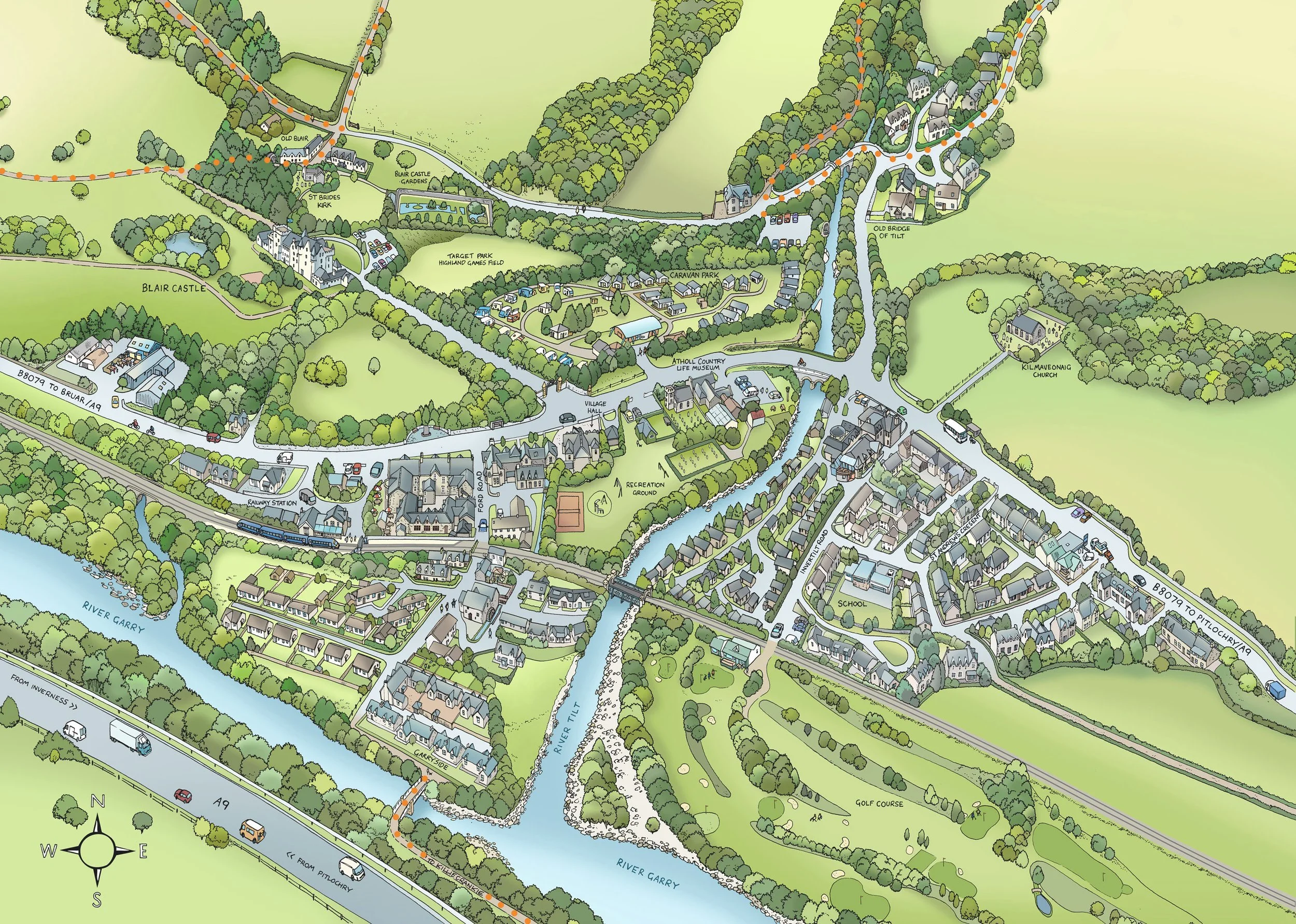
Blair Atholl Tourist map. Illustrated by hand in pen and ink.